Services We Offer
Photogrammetry/ Aerial Mapping
Utilizing our Drone/UAV we are able to perform aerial mapping services that include topographic mapping, construction inspection and site plan development.
Laser Scanning
Utilizing our Trimble Laser scanner, we offer services in BIM modeling, Construction inspection, and utility documentation. Deliverables can include simple 2D floor plans or 3D point clouds in various formats.
Subdivision Design
A subdivision is an area of lands that has been divided into smaller areas on which houses are built. There are major and minor subdivisions, depending on the number of lots to be divided into. Subdividing land includes topography, pre-preliminary survey and design, site analysis, preliminary surveys for each lot, and Subdivision applications. Our office assists in preparing and filing applications.
For more information on Subdivisions and application forms, please visit our LINKS page for a link to the Suffolk County Department of Health Services and town websites.
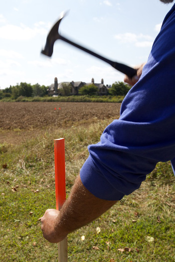
Setting Corners/Monuments
Surveyors set corners to mark a property boundary, and set one each time the boundary line changes direction. We typically use metal stakes, however we can also place concrete monuments. These monuments are used for future surveying work.
Topography
A topographical map shows the elevation contours across a property in 1 or 2 foot increments. We can do this for the entire lot or for a specified portion of the property. Architectural and Aerial topography is also available.
Residential Site Plans
A residential site plan shows the location of proposed structures, pools, walkways, fences, septic systems, etc., and proposed clearing for environmental permits. The work includes the survey, stake-out, and preparation of a map in AutoCAD, topography, a test hole, the location of special features, clearing calculation, and assistance with the SCHD Application.
Commercial Site Plans
A commercial site plan shows the location of proposed structures, pools, walkways, fences, septic systems, etc., parking design, and coverage and total coverage calculation. The work includes the survey, stake-out, and preparation of a map in AutoCAD, topography, location of special features, and clearing calculation. There may be outside fees mandated by government agencies.
Preparation for Natural Resources Special Permits
The Natural Resources Department of East Hampton has a special permit available for coastal restoration projects, and repair or reconstruction of coastal structures. Out office assists in the preparation and filing of the permit applications.
For more information and application forms, please visit our LINKS page for a link to the East Hampton Town website.
Suffolk County Health Department Applications
When you build or improve a home or business, the Suffolk County Department of Health Services (SCHD) requires a permit that ensures that sewage disposal systems and water supply connections are properly designed, maintained and operated, and in compliance with all health codes to minimize the possibility of disease transmission and the potential for contamination of ground and surface waters. Our office assists in preparing and filing the SCHD application for residential and commercial permits.
For more information and application forms, please visit our LINKS page for a link to the SCHD website.
Surveyor’s Statements
Surveyor’s statements are written reports as to the use of a portion of a road to be abandoned. They certify whether that portion is being used or not after an inspection of said road.
Written Property Descriptions
A written description of property boundaries, easements, abandonments, etc., as it appears on the survey map.
Urban Renewal Map Abandonments
Urban Renewal is a program of land redevelopment for town-initiated development projects. This includes the relocation of businesses, the demolition of structures, and the government purchase of property for public purpose. Our office can plan and profile for Urban renewal including; rough staking for clearing, road grade, and recharge basins, curb line and grade, drainage structures, and monumentation.
Map Preparation in AutoCAD Format
Although we still maintain some hand drafted surveys, most of our surveys are digitally drafted on a computer in an AutoCAD program. We can redraw old hand drafted maps into the new computer drafted style.
Land Use Planning
Land use planning is the design of land use and its application for environmental permits.
For more information, please visit our LINKS page for links to town websites.
Accident Investigation Surveys
Accident Investigation surveys map the scene of an accident so that investigators can better determine the cause. They can also be used to assess risks and determine factors that could lead to an accident.
Hydrological Surveys
A hydrological survey measures the depth of water for dredging projects, or dock design.
ALTA Surveys
An ALTA survey is a boundary survey prepared to a set of minimum standards that have been jointly prepared and adopted by the American Land Title Association (ALTA) and the American Congress on Surveying and Mapping (ACSM). It is often prepared for commercial properties. An ALTA survey shows improvements, easements, rights of way, areas of ownership, encumbrances, and other elements impacting the ownership of land, and includes the names of the affected parties, including the buyer, seller, Title Company, and lender.A current title commitment is required before an ALTA Survey can be completed.
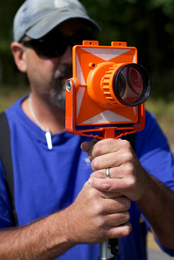
Surveys
A new survey shows property boundaries, all existing structures, driveways, walkways, fences, clearings, and/or encroachmentson an easy to read map. An updated survey shows improvements to the property, but does not include the location of encroachments, property lines, or setting the corners, and must be done for the same owner. This information is shown on a computer drafted map.
Visit our FAQ section for more information on why and when you need a survey.
Stake-Outs
A stake out is performed for new surveys, and/or proposed new structures on a property.Used for construction layout.
Flood Elevation Certificates
For houses built near oceans, creeks, harbors, and other areas prone to flooding, insurance companies may require a National Flood Insurance Program Elevation Certificate from the Federal Emergency Management Agency (FEMA). This certificate determines the proper insurance premium rate. Our office assists in preparing and filing the application.
For more information on Elevation Certificates and Flood Insurance, please visit our LINKS page for a link to the FEMA website.

About Our Services
At Walbridge Surveyors we strive to maintain a reputation for providing top quality services to our clients. We offer a broad range of services to an extensive community that includes land owners, lenders, title companies, real estate investment firms, commercial brokers, architects, engineers, contractors and developers.
Areas of Services
Walbridge Surveyors serves clients in The Hamptons, from Montauk to East Hampton to Southampton and our areas of service include: Shinnecock, Southampton, North Sea, Watermill, Noyac, Bridgehampton, Sag Harbor, North Haven, Wainscott, Sagaponack, Northwest Harbor, East Hampton, Amagansett, Springs, Montauk, Shelter Island, Shelter Island Heights and Gardiner's Island.